

Watch the video of the trail:
Description of the trail:
The trail is situated on the eastern shore of Lake Plateliai. It allows not just to see, but also to experience the hilly relief of Žemaitija National Park, which is immensely picturesque along the trail. Which means that due to a number of long and steep climbs the trail is not accessible to people with movement disorder and parents with baby-strollers. The trail might also be difficult to seniors.
The relief of Paplatelė neighbourhood was formed by the last glacial period 13-13,5 thousand years ago. The hills reach a height of 189 m above the sea level. This trail is the only one in the National Park where wooden sculptures, created following the motives of Lithuanian fairy tales, have survived from the 9th decade of the 20th century. Several sculptures are tailor made to meet the needs of agile children and those who seek active rest. The trail runs its first 300 m through the Woodland Key Habitat. This is a wooded area not affected by economic activity, or affected at the slightest extent, where one may come across to some endangered, vulnerable and protected rare species of plants, fungi and animals. The habitat existing here is attributed to the type of pine forests and mixed woods with single pines, with the area of 10,5 ha and century-old pines and spruces. The trail meanders along the Pond Sultekis, formed in the 8th decade of the 20th century, which is slowly becoming into a swamp. The watching tower nearby opens great view to the pond and the forest surrounding it. Here, you can see and listen to various birds – Honey buzzard Pernis apivorus, Marsh Harrier Circus aeruginosus, Common buzzard Buteo buteo and other. Also the protected Common spotted orchids Dactylorhiza fuchsii grow by the pond. In the woods you shall see anthills and paths trodden by various animals (moose, roe deer, wild boars), as well as hollows hammered by birds of woodpecker family.
Download the GPX of the trail
In order to open the GPX file with the trail route on a mobile phone or computer, please install one of the hiking apps or maps, e.g., Wikiloc, Outdooractive, ViewRanger, OS Maps or any other GPX file reading programme or application.
Location: Žemaitija National Park, Plungė District Suggested starting point: Parking lot near the trail in Paplatelė Village (close to the guest house Banga), 11 Plokštinės Street
Starting poing of the trail in the map: Lat: 56.04684, Lon: 21.8858
Accessibility: 
Hiking time: 40 min
Distance: 2,5 km
Marking: Marked with direction signs
Type: Loop
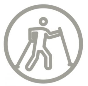
Difficulty: 
Segums: Path, asphalt
Facilities: ![]()


![]()
![]()
![]()
![]()
![]()
 at Visitor Centre in Plateliai
Watching tower
Getting there: by car. Driving through Plateliai head northwards towards the main road Plungė-Mažeikiai, about 7 km. Turn right onto Plokštinė Street and drive straight until you see the sign – Pažintis takas (Cognitive Trail). Driving along the main road Plungė-Mažeikiai, Plokštinė Street is 6 km away from the crossroads of Mažeikiai-Alsėdžiai-Plungė
Rules to follow: ![]()
![]()


![]()


Trail administrator: Žemaitija National Park Directorate, tel. +370 448 49231; e-mail: info@zemaitijosnp.lt
Info:
Žemaitija National Park Visitor Centre, 8 Didžioji Street, Plateliai, tel. +370 448 49231; e-mail: info@zemaitijosnp.lt, www.zemaitijosnp.lt/en/
Cold War Museum, 4 Šilinės Street, Plokščiai Village
Closest shops: Plateliai, Plungė
Closest gas stations: Plateliai, Plungė